Email: sales@cadssurveys.co.uk
Telephone: 01493 440444
Topographic Survey Supporting a 17-Acre Mixed-Use Redevelopment

Key Metrics
- 17-acre integrated public services community village
- Completed within 4 weeks
- Underground utilities survey deliverable
- 2D topographical site plan deliverable
Comprehensive topographic survey
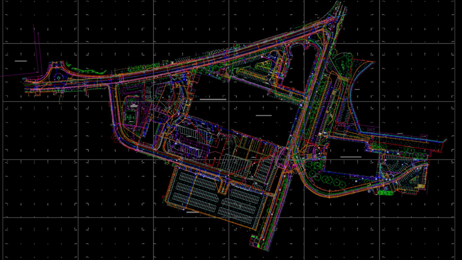
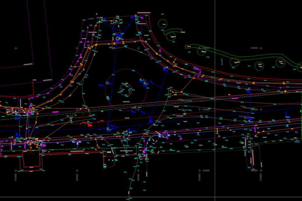
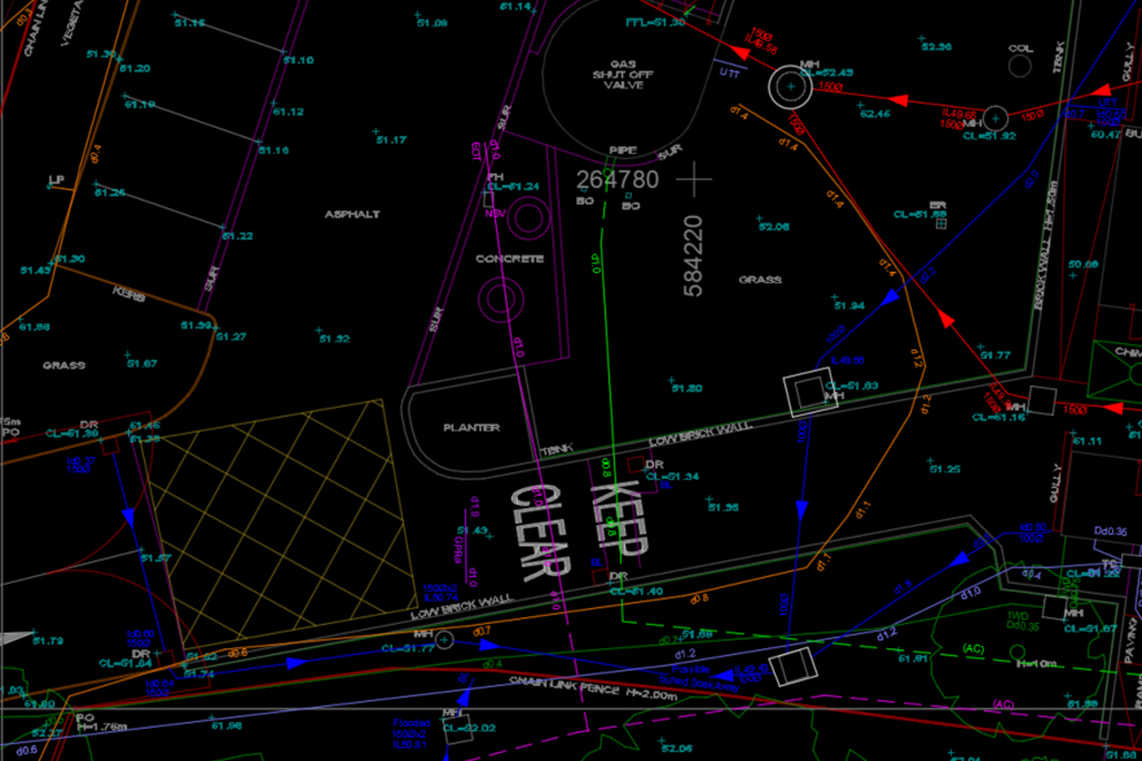
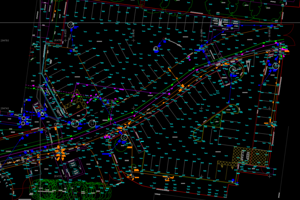
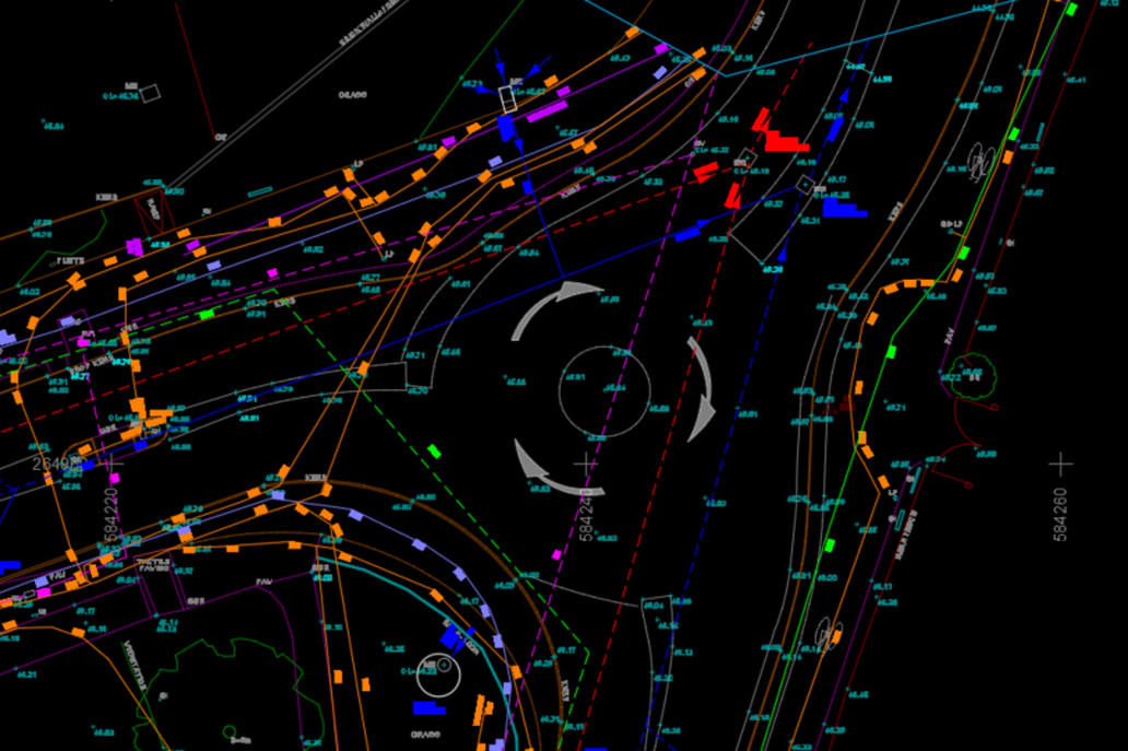
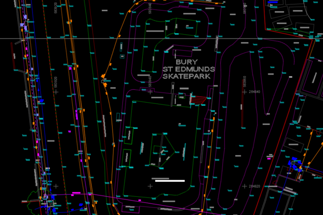
CADS Surveys delivered a comprehensive topographic survey and underground utilities survey for the Western Way redevelopment in Bury St Edmunds, providing the accurate site data needed to progress a multi-million-pound mixed-use development from planning through to design.
Located close to the town centre, the site forms part of a large-scale community-focused scheme featuring new homes, green spaces, and modern amenities.
Commissioned by Pick Everard, the survey covered the full 17-acre site and produced a 2D topographical site plan and underground utilities survey, forming a critical foundation for the project’s architectural and development proposals.
Learn more about our topographical surveys for the commercial sector, or explore more of our surveying projects.
Contact us today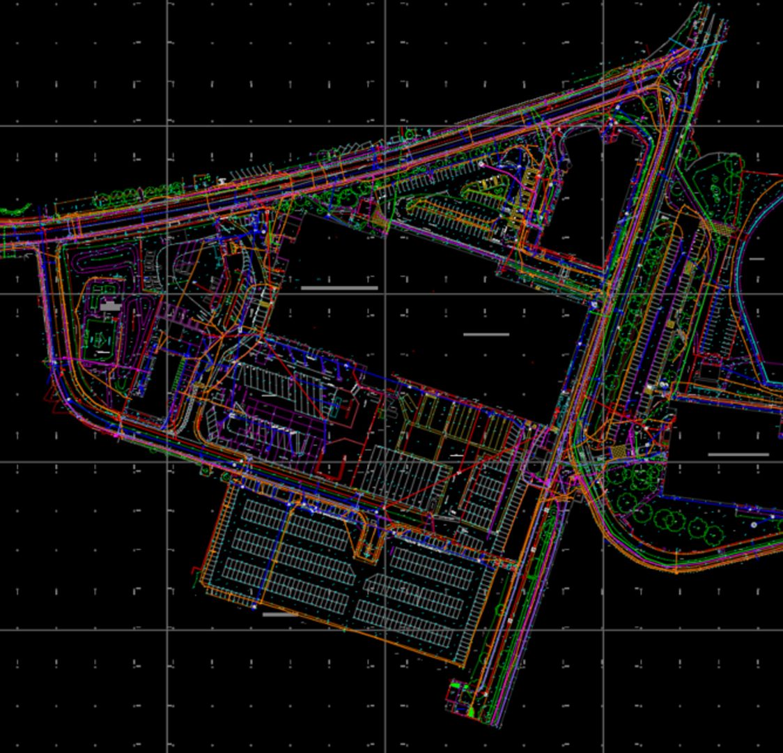
Ready to get your project started?
- Call Us
01493 440444 - Email Us
sales@cadssurveys.co.uk - Message Us
Submit an enquiry